Reading: The Constant Rabbit (Jasper Fforde) & An Unsung Hero (Michael Smith)
Weather: NE 2-4 – variable. Awkward swell again but clear for most of the day ….
Thought for the day: Is it noble or lazy for me to offer to steer whenever they are doing a workout?
Evening meal: Chicken curry and pilau rice
Course: 185-200oC
Distance covered: At 1200 we had done 3,222 miles
Wildlife headcount: A few small birds – skua like and shearwater like, but not close enough to identify properly …..
When we started our watch at 6am this morning the breeze had come up a little during the course of the night but it fairly quickly came up quite a bit more until we had a NE5 blowing us along nicely. For much of the morning watch we were doing between 7.5 and 8.5 knots over the ground, though we were probably being helped a little along by the Brazilian Current as well. This imaginatively named current flows unsurprisingly down the Brazilian coast – luckily for us in a southerly direction. We are maintaining a southerly course over the ground even though the Brazilian coast is heading away to there west as we have another set of offshore obstacles to avoid – once again a couple of islands.
The islands are called Isla da Trindade and Isla Martin Vaz but inshore of them are a good reminder of the fact that while all we can see is water (!), there is a lot going on underneath it. Between Isla da Trindade and the coast are a series of seamounts – effectively mountains under the sea. They are called the Vitoria-Trindade Seamounts and you could think of them as failed islands – they tried to make it to the surface but never quite made the first grade to be called an island, so they are relegated to being seamounts. Some of these are quite significant. We are aiming to avoid one of them which is just 81 metres deep. Of course we don’t draw 81 metres so we wouldn’t hit it, but within a mile or so of this sea mount the depth is over 3 kilometres again, so the possible turbulence that might be caused on the surface by this chasm under the water is best avoided.
When you look at the chart of the South Atlantic these seamounts are all over the place. A short way from St. Helena Island is one imaginatively called Bonaparte Seamount, but the roll call elicits intriguing thoughts about how they have been named (and when they were discovered): Ewing Seamount (named after Dallas?), McNish Seamount, Discovery Seamounts, Schmitt-Ott Seamount, Erica Seamount and the presumably ironically named Argentina Seamount – ironic given that it is just south of Cape Town!
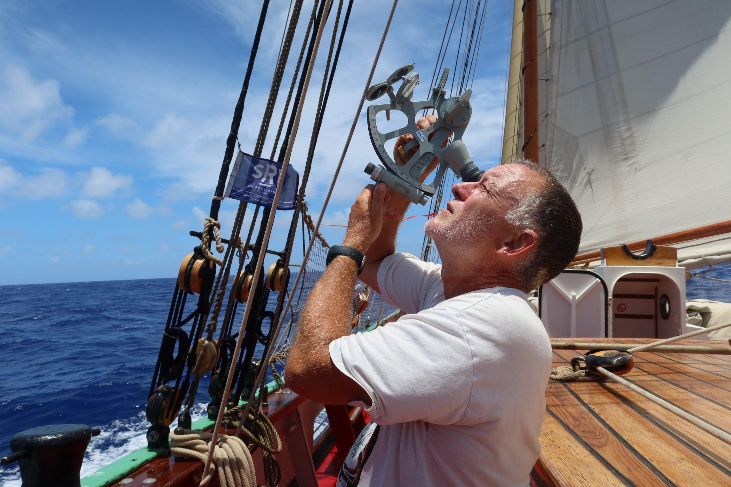
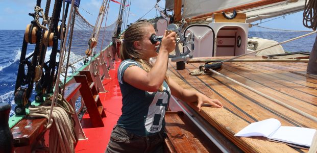
At lunchtime Sanne and I had another go at setting our position with the sextant. Unfortunately lunch was very nice, so we were a bit late starting and missed local noon. However, we carried on for the practice. We started by looking up the meridian passage of the sun from the almanac and then used that to calculate the time that the sun would be at its peak locally. Then (late) we tried to actually ’shoot the sun’. I have done this before but was surprised at how tricky it is where we are. Because we are only 20 degrees south in latitude the sun is still incredibly high in the sky, so bringing it down to the horizon from over 80o in height when rolling around it quite tricky. We managed, sort of, with Jet’s help and ended up with an angle of around 83o 43’. Then we started the calculations – adjusting for index error on the instrument, refraction and parallax and then also an adjustment because of the height of the sun in the tropics and the distortion that causes. Once all those have been applied we could calculate the zenith distance and apply that to the declination of the sun to give us our actual latitude. Slightly worryingly we ended up over 10o out until Jet pointed out that the zenith distance was southerly as well as the declination so we should have added and not subtracted – a simple error! Once that was corrected we got the latitude but suffice it to say, we won’t be using our celestial navigation skills to navigate us around these islands ….