We have come back to the boat after heading home to go to the Olympic Park to watch the hockey and have decided to use the boat as a base for a week or two to explore Northern Ireland. We have hired a car and plan to head off in various directions each day and see what we can discover.
Follow the ‘Continue reading’ link below to see what we did each day.
See the Northern Ireland picture gallery for more photos.
Saturday 4th August – The North Antrim Coast
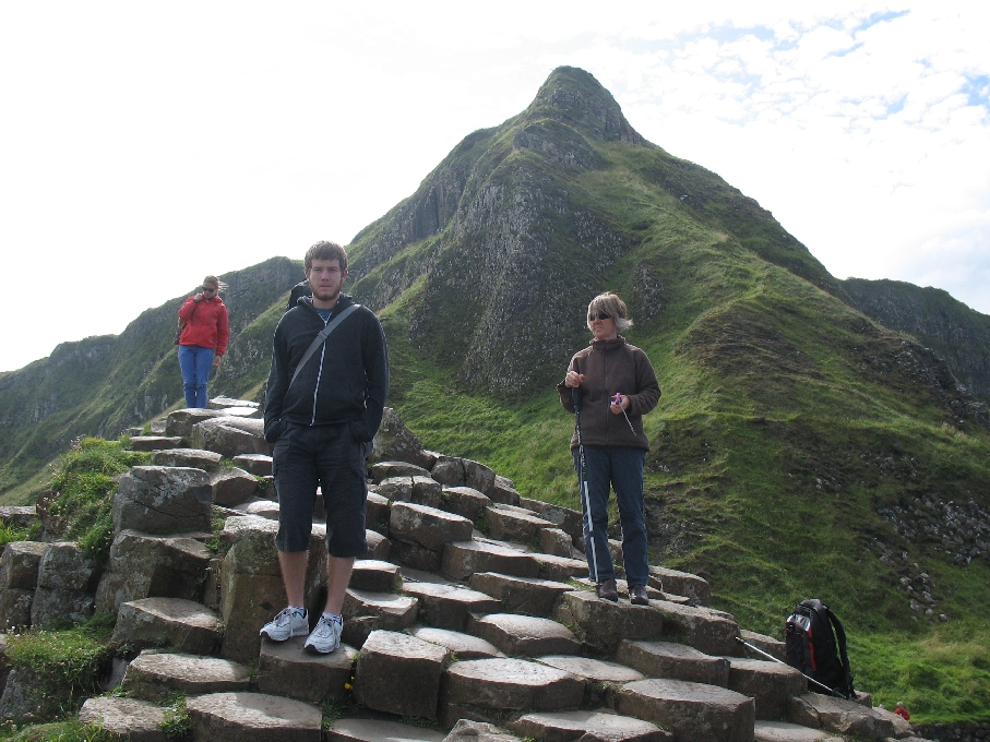
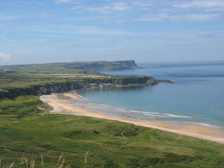
Today we headed north. Up the M2 and A26 out of Belfast to the Giant’s Causeway. Though the causeway itself was not perhaps as extensive as we had expected, the coast itself surpassed all our expectations. Beautiful beaches, extraordinary rock formations, clear blue water and incredible views across to Islay, Jura and mainland Scotland were all on offer along this part of the coast.
The Giant’s Causeway is so named after the giant Finn MacCool who built it as a bridge to Scotland. The legend goes that a Scottish giant called Benandonner challenged Finn. Benandonner was much bigger and Finn didn’t much fancy fighting him, so Finn’s wife came up with an ingenious plan. When Benandonner came over the bridge looking for Finn, she disguised him as her baby. She told Benandonner that Finn was out woodcutting and showed him her baby. When he saw the size of the ‘baby’, he decided that discretion was the better part of valour and fled back across the Scotland ripping up the bridge behind him. The reality is much more boring in that the causeway was formed as a result of intense volcanic activity in Antrim. Molten basalt made its way through the chalk and cooled rapidly, contracting as it cooled. As it contracted it cracked leaving vertical pillar-like structures. The legend chimes with reality in that there are similar basalt columns as a result of the same lava flow at Fingal’s Cave on the Isle of Staffa in Scotland.
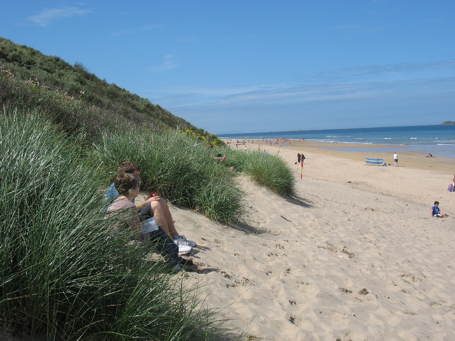
From the Giant’s Causeway we went west to Dunluce Castle and had lunch on Portrush beach – possibly one of the most beautiful beaches we have ever seen. Sweeping sands running for several miles round to Portrush at the western end.
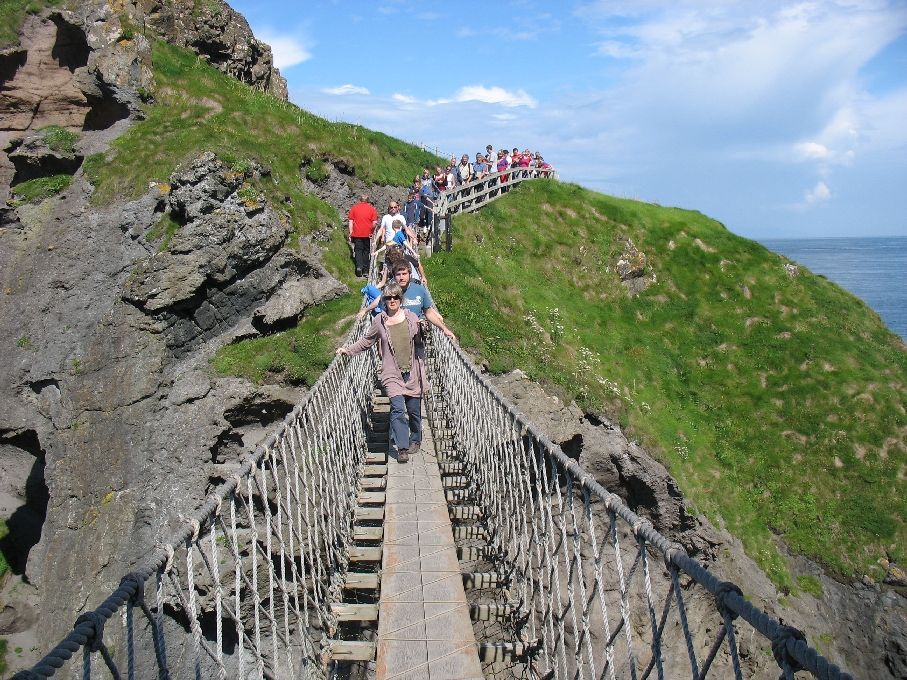
From there to the Carrick-a-Rede rope bridge. This bridge is now owned by the National Trust, but it was originally used by salmon fishermen to check their nets. The nets were attached to the island and then stretched out to sea to catch the Atlantic salmon as they were pushed through the gap between the coast and Rathlin island by the strong tides. The commercial salmon fisheries along the coast were all bought out in 2001 to protect the depleted fish stocks as the Atlantic salmon is now an endangered species. The National trust are trying to restore the island (actually called Carrick-a-Rede island) to how it was when used for fishing and they have restored the bothy and are having replica drontheim boats built.
Sunday 5th August – Strangford Lough
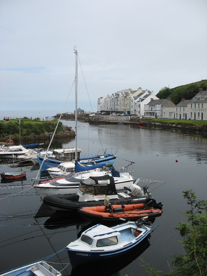
Today, by contrast, we headed east and then south. We drove out of Bangor to Groomsport and then on to Donaghadee – a small fishing port on the coast. We had sailed close past Donaghadee on the way in as you have to come through the narrow sound between Donaghadee and Copeland Island to save a long sail round the islands into Belfast Lough. It was nice though to see it from the shore. from there we drove down the coast to Portaferry.
Portaferry is on the north shore of Strangford Lough. The car ferry goes from here across to Strangford, saving a very long drive round the north of the lough. The name Strangford is derived from Old Norse and means strong fjord – a reference to the very strong tidal streams running throuhg the narrow entrance to the lough. In Irish, it is called Loch Cuan – cuan meaning calm. This is a reference to the other side of the lough – the shallow mudflats in the northern section. The lough is the largest inlet in the British Isles covering 150 square kilometres.
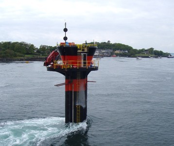
The lough also has in the narrow entrance the world’s first commercial tidal stream generator. The SeaGen is capable of generating enough electricity (1.2 megawatts) to power around 1,000 homes, though it is said to have a minimal impact on the environment as the blades turn so slowly.
A further tidal energy device called the Evopod is also being tested at Portaferry by Queens University Belfast. It is a semi-submerged tidal turbine, though currently the electricity generated is just dissipated as heat as it is not connected to the grid.
Monday 6th August – Belfast
Today we headed into Belfast. We took the train for a gentle (for ‘gentle’ read ‘slow’) train ride into Belfast. We got off at the Botanic Gardens stop and had a wander round the Palm House and Tropical Ravine. The tropical ravine was quite unusual as you walk around a walkway looking down at the plants – the building was dug out to allow for the plants to be planted low down, so effectively we were walking through the tree-tops.
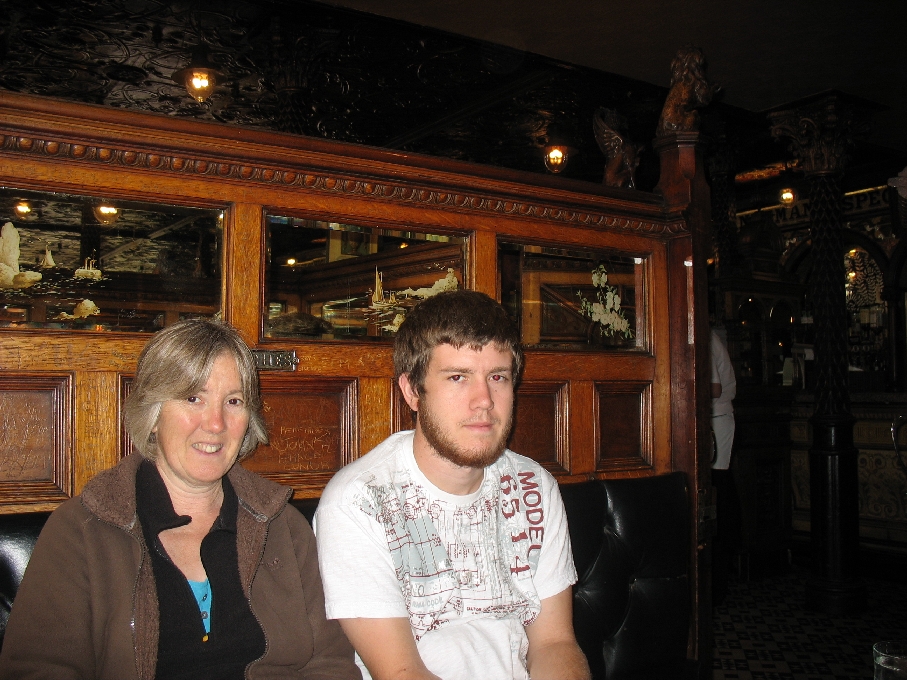
From there we walked past Queen’s University Belfast to the Crown Bar for lunch. The Crown Bar is an unusual pub in that it is owned by the National Trust. It is described as a ‘Victorian gem’ and is a great example of the Victorian Gin Palaces that used to adorn industrial cities in Britain. The bar was originally called the Railway Tavern and was created by Italian craftsmen who the owner, Patrick O’Flanagan, persuaded to work on the bar after hours. These craftsmen had come to Ireland to work on the many churches being built at the time and much of the decor of the Crown is reminiscent of church architecture – elaborate wood carvings, stained glass windows and mosaics. One of the main features of the pub is 10 ‘snugs’. These are private wooden booths with doors and were originally to maintain privacy for Victorian drinkers. In 1978 the National trust were persuaded by various people (including John Betjeman) to purchase the Crown and did an extensive restoration. A further £500,000 restoration was done in 2007 and the Crown now has Grade A listed status.
From the Crown we walked through to City Hall and then around the City to end up at the Titanic exhibition. This opened in March 2012. From the air it apparently (we didn’t look from the air, so can’t confirm this!) looks like a star – representative of the White Star Line who built her. The four corners of the building represent the bow of the ship and the iceberg and each ‘bow’ is apparently the same height as the Titanic herself. The building certainly stands out and though for some it may be an acquired taste, it is certainly interesting and eye-catching. It was clearly very busy, so hopefully they will quickly recoup the £77m it cost, most of which came from the public purse.
The Titanic was built at the Harland & Wolff yard which is right next door to the new Titanic exhibition. Indeed the slip where the Titanic was built adjoins the exhibition building. Also built at the yard in Belfast were the White Star Line Olympic and Britannic and HMS Belfast. The twin cranes at the yard are called Samson and Goliath and they have become local landmarks. However, they are not used much any more as the yard has switched from shipbuilding to fabrication for the offshore renewable wind market. 75% of the work done by the yard is now for this market with the rest being repair and other work for ships.
See the Northern Ireland picture gallery for more photos.
Tuesday 7th August – The Glens of Antrim
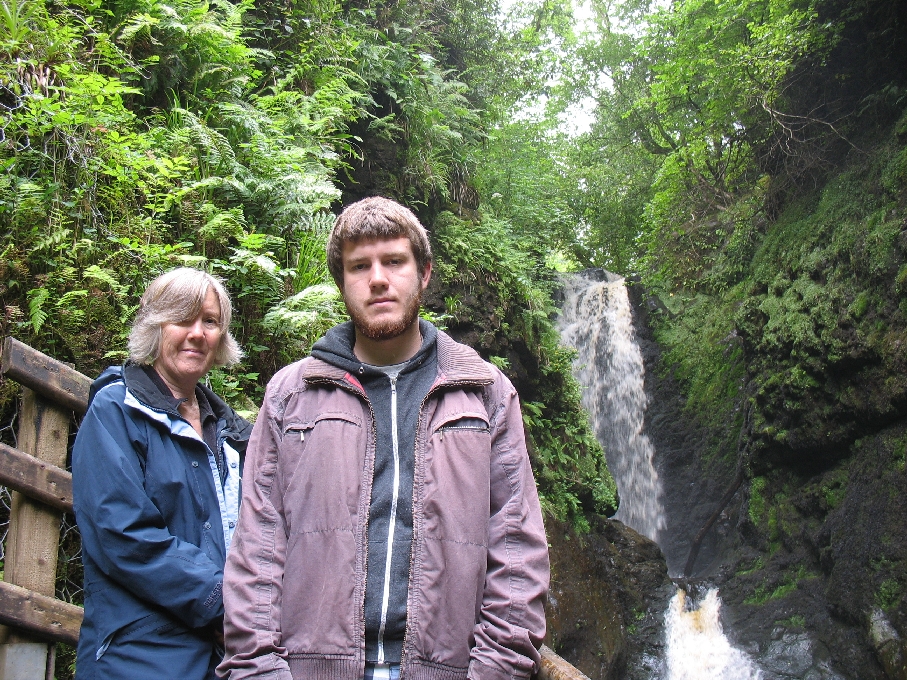
Going along with the theme of this trip, the weather decided not to play ball today. We planned to head out to the Glens of Antrim – a section of the North Antrim coast where nine different glens come down to the coast. The most accessible and beautiful one is Glenariff (meaning the glen of the ploughman or fertile glen – often called the ‘Queen of the Glens’) and much of this is a national nature reserve called Glenariff Forest Park. The glen is a great example of a glacial u-shaped valley and has two rivers feeding into the valley – the Glenariff River and the Inver River. The weather had closed in and was murky and drizzly with cloud over the tops, so rather than do the 6 mile trail, we chose to do the short 3 mile trail that heads down and follows the waterfalls of the Glenariff River. It was a beautiful trail and much of it was a wooden walkway along the river. This was apparently originally built over 80 years ago by the railway company to try and encourage tourists to come into the valley on their narrow gauge route – quite an effort to drum up business for the railways and not one I can see happening in these more enlightened (?) times.
After Glenariff we headed for Cushendun on the coast for lunch. This was a lovely lunch stop – a very small village owned by the National trust. It had a tiny harbour with a row of ‘cornish-style cottages’ which were the work of Clough Williams Ellis (the Architect of Portmeirion), though they had clearly been restored and looked considerably more modern.
From there we took the coast road back down to Glenarm and had planned to stop, but with the rain setting in we decided to head for Larne and then back to Bangor.
Wednesday 8th August – Mosying around the Mourne Mountains
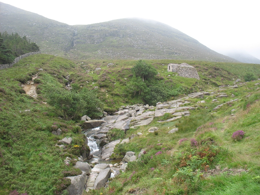
On the way up the coast we sailed past the Mourne Mountains. Well, you couldn’t really miss them. Rising from the sea to their highest to 850 metres, they are an impressive range of mountains between Kilkeel in the south and Newcastle in the north. having seen them from the water, we thought it would be nice to see them and even walk up one of them. So, we chose to walk up Slieve Donard – the highest mountain in Northern Ireland. Once again, the weather determinedly decided not to play ball. We left Bangor in bright sunshine and arrived to find the mountains swathed in cloud. Still, we were there and the mountains were there as well, so we started walking. Parked at a car park on the southern end of Newcastle (a lovely seaside town), we set off through the Donard Forest. Immediately the walk was lovely – past waterfalls through broad-leaved forest with the river rushing down over granite plateaus and through the woods.
The path followed the river and after ascending about 300 metres, we came across the ice house. This was apparently constructed in the 19th century by the Annesley family, then the landowners of Donard Park. It was effectively a primitive fridge. Most of its volume was underground to keep the temperature down and food and meat were stored in between the layers of ice to keep them cool and help it last longer. Ice houses were common in larger manor houses and were an ostentatious sign of wealth for the landowner.
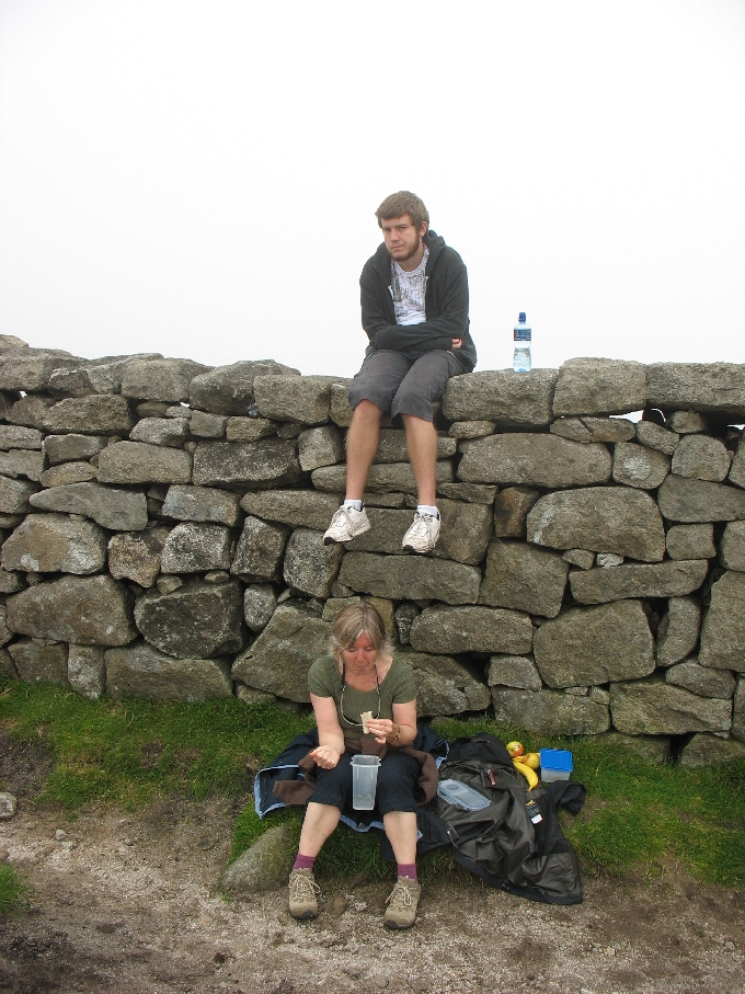
After the ice house the path followed the river steeply upwards to a saddle between Slieve Donard and Slieve Commedagh. Running between the peaks across the saddle was a granite wall known as the ‘Mourne Wall‘. The wall is in fact 22 miles long and took 18 years to build between 1908 and 1922. It runs over most of the peaks of the Mourne Mountains and was built by the Belfast water Commissioners to enclose and mark the water catchment area for the Mournes. It is a really useful navigational feature and is clearly still well maintained. it is made of granite using dry-stone walling techniques and is around 5 foot tall throughout its length – quite a feat to have built it all.
We had lunch by the wall and though the peak of Slieve Donard was only 0.8k away (and 250 metres higher!) we decided not to continue as it was still shrouded in cloud, so we headed back down. In all the walk took around 4 hours. On the way home we did a detour via Killough and Ardglass along the coast – a lovely route and nice to see features we had seen from the water from land.
Thursday 9th August – The magnificence of Mountstewart House and Garden
With a lovely sunny start to the day we headed for the fuel berth and filled up, got a new gas bottle and pumped out the holding tank. Then we went out into the Lough for a sail for a couple of hours – very quiet and peaceful with only a NE2 but nevertheless very relaxing.

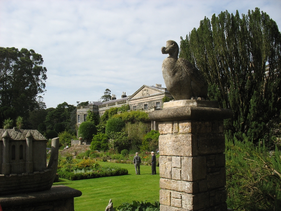
In the afternoon, we got back in the car and headed to the south of Newtonards to a National Trust property – Mountstewart House. The gardens were a real eye opener. We walked initially round the lake at the front of the house and past the family burial area in the grounds. The lake was a considerable size – the walk around was about a mile in length – and beautifully landscaped with a range of very old specimen trees around it. In the sunshine, it was a very peaceful and relaxing place to be. The we headed round the back of the house to the formal gardens. These were amazing – an Italian garden, a Spanish garden, a sunken garden and a wierd terrace called Dodo terrace with statues of Dodos and various dinosaurs alongside each other. There was also some fairly extreme topiary with a harp, a horse and rider, a ship and a person with a bow and arrow – someone is very clever with the secateurs!
We then went round the house. We were given a tour as it is currently being extensively refurbished and there are still family members living there. Mounstewart House was originally known as Mountpleasant House and was the home of the Stewart family – the holders of the Marquess of Londonderry title. Alexander Stewart bought the estate in 1744 and gradually improved it. Alexander’s grandson Robert (known as Viscount Castlereagh) died just a year after he inherited the estate and it passed to his half-brother Charles. He seems to have been quite shrewd as his second marriage was to Lady Frances Anne Vane-Tempest – possibly the wealthiest heiress of her time. It was then that most of the current house was created and they spent £150,000 refurbishing the property. Generously, they also found it in their hearts to donate £30 at the same time to the victims of the Irish famine. Plus ca change ……. In fact they hardly used Mountstewart House as they also had large houses and estates in County Durham, Dublin and Park Lane in London. The gardens were mainly created by the wife of the 7th Marquess in the early 20th century by which time the house was actually lived in. The gardens were given to the National Trust in 1957 and the house and most of its contents were added in 1977. The direct relations of the family continued to live there till 2009 when Lady Mairi Bury died.
After going round the house we walked up to the Temple of the Winds – an octagonal building that the 1st Marquess was apparently inspired to build following what he saw on his ‘Grand Tour’. See the Northern Ireland picture gallery for more photos of the house and gardens.
Friday 10th August – Sauntering round the Sperrin Mountains
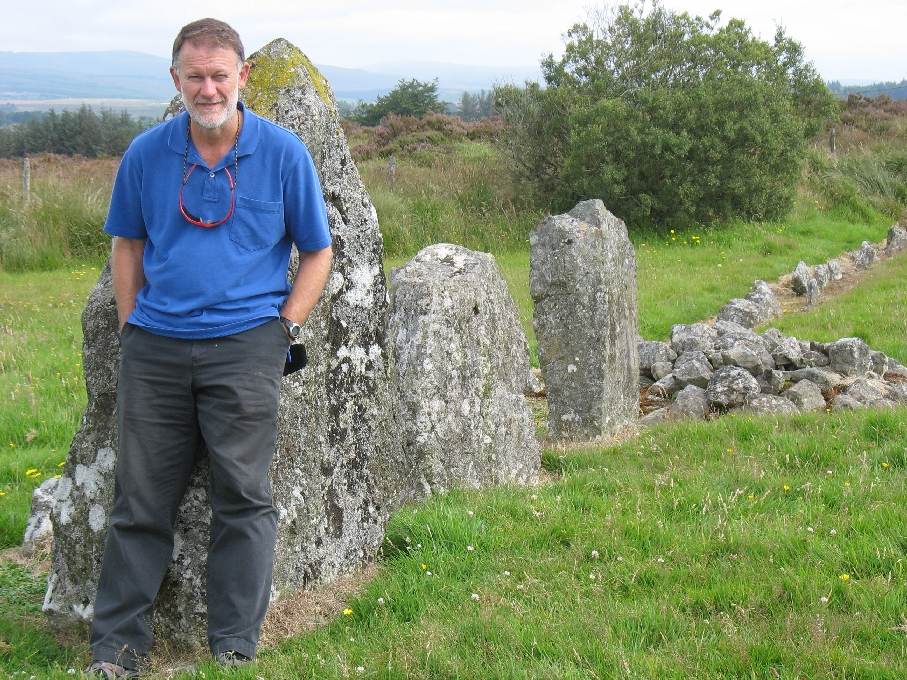
After dropping Alex at the airport early for his flight home, we decided to stay out to the west and headed for the Sperrin Mountains. After breakfast in Magherafelt we decided to do a scenic drive around the east Sperrins. The Sperrins are a distinctive glacial landscape with gently rolling hills and uplands and heather and heathland areas. There were also extensive peat areas, some looking like they had been dug out. We stopped on the way at Beaghmore stone circles. This early Bronze age site had seven circles – all remarkably accurately formed circles. Six of the circles were paired, often with one or row of stones leading into them and the final circle stood alone. This solitary circle (circle E) also had around 800 small stones set into the middle of it, called ‘Dragon’s Teeth‘.
In the first pair of circles (A & B), the rows of stones leading in were aligned with the sunrise and moonrise at the summer solstice, so the site may have had religious significance. Each pair of circles also had cairns where traces of human bones have been found, so they were also used as a burial site. After visiting this site we returned to the marina and this afternoon dropped the car off.