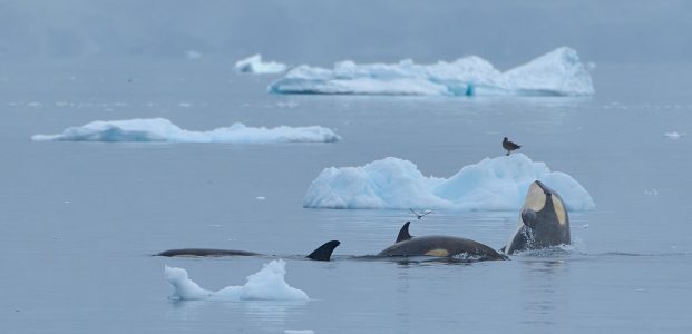
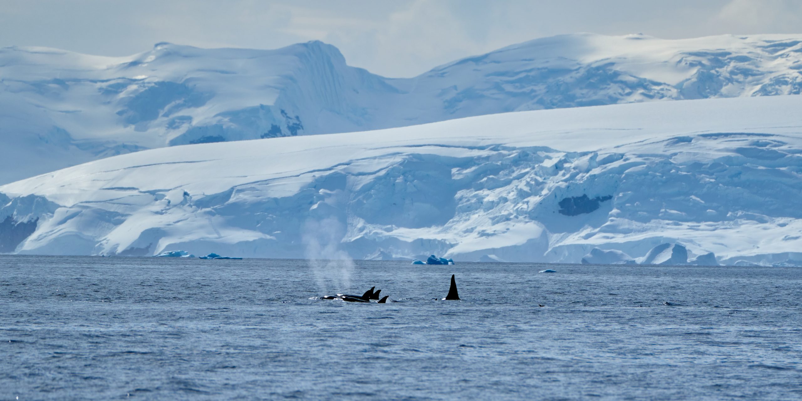
A leisurely start after breakfast saw us motoring south once again towards Cape Herschel. Progress was quickly slowed though by a shout of ‘whales’ as a pod of humpbacks cruised languidly past. Then someone spotted a pod of orcas in the distance. The fin of the alpha male stood out sharply towering above the others. They were circling rapidly and so presumably feeding, though it was perhaps better not to speculate on what as one of our crew described them as maritime killing machines! The whale watching lasted about ten minutes before we turned once again south, though interruptions for whales were common throughout the day.
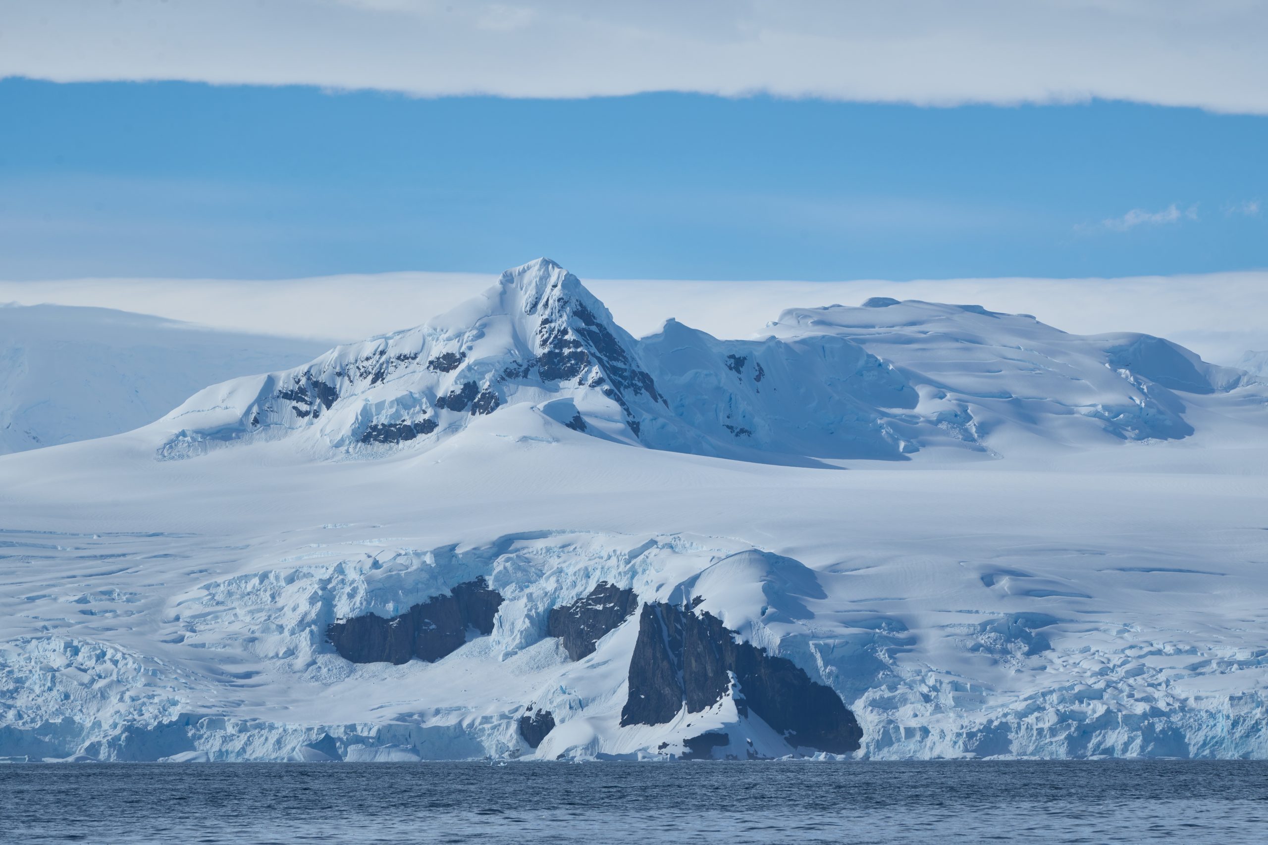
The passage south was stunning. Initially it was clear with the mountains, snow fields and glaciers of Graham Land lining the way, but rapidly we moved into an ice field with the usual variety of shapes and colours to the icebergs. Weaving our way through was relatively straightforward, but took a good deal of concentration from the helm. For the rest of us, watching the icebergs in the bright sunshine was one of the better spectator sports and, as ever, simply left us in awe of the landscape and the elemental forces of nature which created it.
This section, as we move south past Cape Herschel, takes us into the Gerlache Strait. This is named after the Belgian explorer Adrien de Gerlache who led the first Belgian expedition in 1897-99. They mapped the Antarctic peninsula in new levels of detail and there are still 45 place names in use today which were given by this expedition. This includes two of the large offshore islands – Anvers Island and Brabant Island – as well as bays like Wilhelmina Bay, named after the Queen of the Netherlands at the time who was a prominent supporter of the expedition. The expedition was trapped in the ice in February 1898 and drifted for over a year with many of the crew suffering badly from scurvy and related illnesses.
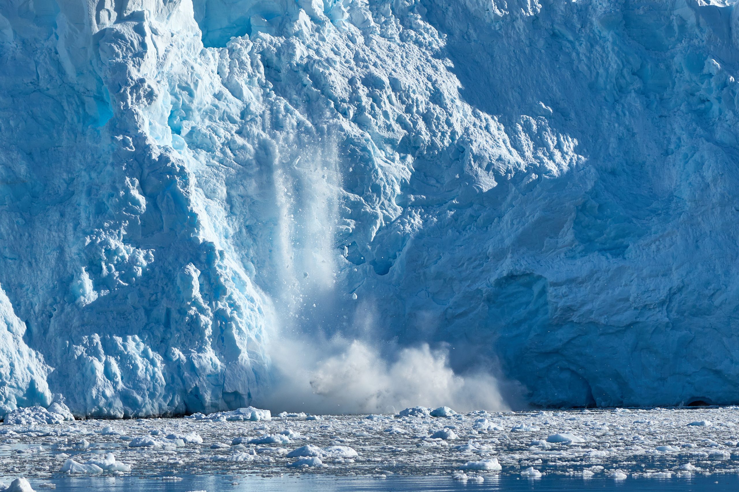
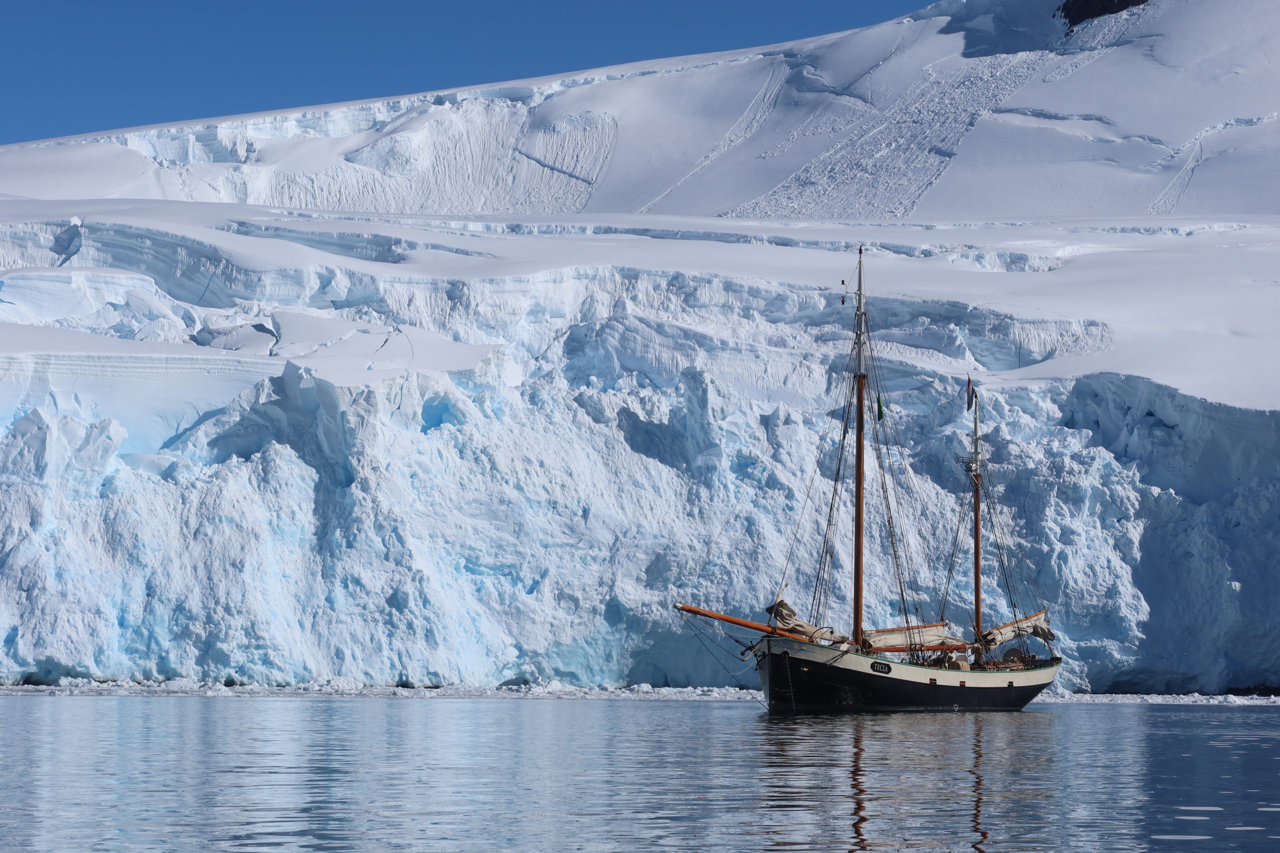
Our destination for the night is a small bay called Murray Harbour. This is a bay between Bluff Island, Challenger Island and the peninsula. There are a few gaps through into the bay and we headed for the northern one only to find icebergs blocking the entrance. With a lookout stood on the bowsprit and some intricate manoeuvring we weaved our way between two of them with just feet to spare either side and came into a beautiful bay, surrounded on all sides by glaciers. The clarity of the water and the sunshine meant that we could often see the bottom even though it was 6-10 metres deep. Once anchored we were regularly accompanied by a deep booming sound as chunks fell from the glaciers around adding to the small chunks of ice lining the shore.
The change of wind and current during the night meant that during the night time ice watch, the whole pack of ice drifted past us, so we had to pole off the larger chunks and keep everything clear of the rudder. Otherwise, we just left it to drift in its own way. To do anything else would have been futile anyway!