Utklippan is a wierd anomaly – two islands called Södraskär (South skerry) and Norraskär (North skerry). They are the most southeasterly point of Sweden and there is virtually nothing there. So … an ideal place to stop! Actually it is a good place to stop as it is an ideal staging post from anywhere south to head up the Kalmarsund, plus, the unusual nature of the harbour makes it very intriguing. The islands are about 10 miles from Karlskrona to the south east, so can be popular with overnight visitors from Karlshamn, Karlskrona and other places in the Belkinge Archipelago, but the main visitors when we got there seemed to be German and other passage making yachts on their way north. From Rønne it is about a 65 mile passage and with a good forecast, we decided to head off at 05.15. The wind was very light initially and it was grey and cloudy so we had to motor for a few hours, but around 9am the sun came out and the breeze seemed to settle in, so we started sailing. However, the wind was just teasing us and an hour later the engine came back on again ….
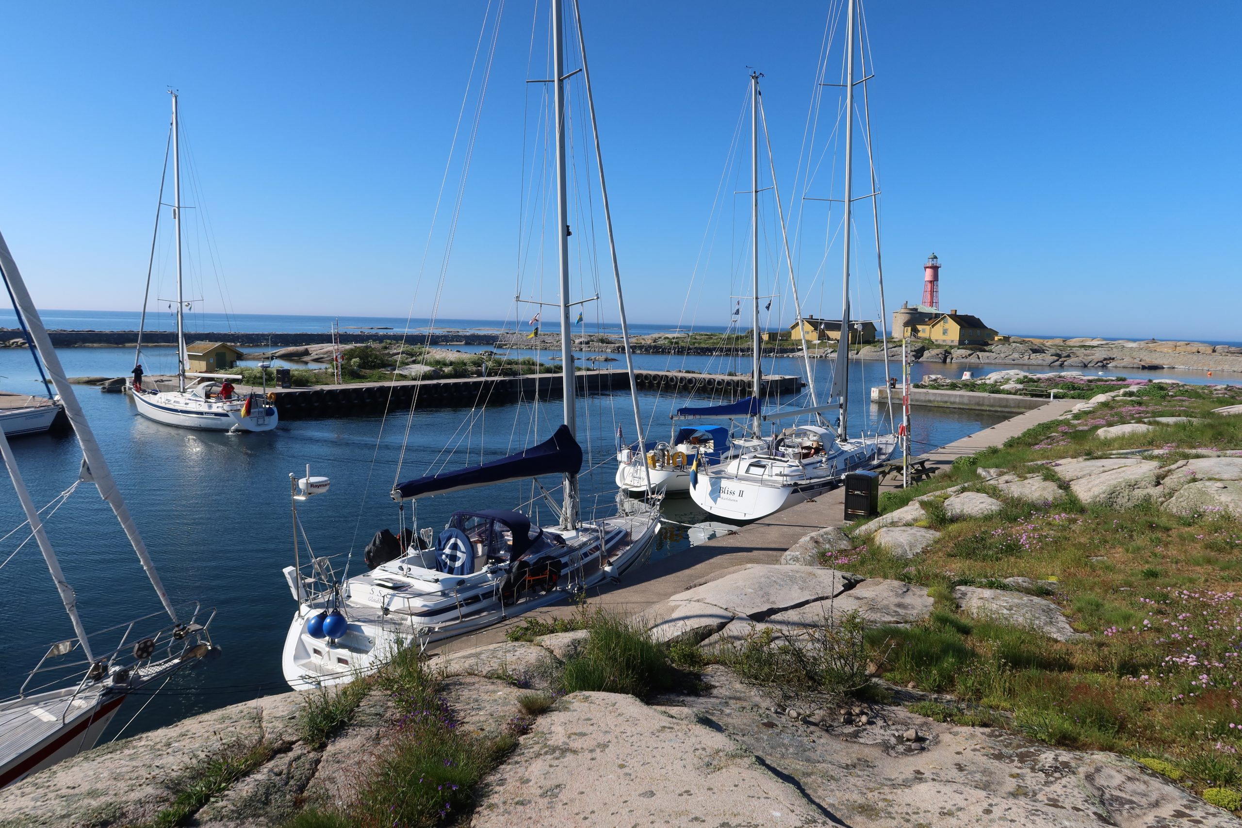
It took until 2.45 for the wind to come back again and with a bit over 10 knots of breeze almost dead astern we managed to goosewing (also called ‘gull wing’ or ‘wing and wing’) our way towards Utklippan for another couple of hours. Around 5pm we took the sails down and headed into the eastern entrance to Utklippan. Making your way through the rocks and then past the moles and across through a narrow passageway into the harbour is one where it is tempting for the skipper to close his eyes and hope for the best. However, that approach will definitely not lead to the best outcome, so hands clenched around the wheel we made our way in. All of this is not helped by the clear water. In fact the water was so clear that we could see every single rock in cinematic detail – oh for murky east coast water …. at least that disguises what is underneath you. However, we made it in and found a fairly full harbour, so we ended up alongside a very friendly Swede with a Hallberg Rassy 44. When choosing people to go alongside, a bigger boat is always a good strategy! We ended up doing 64.3 miles in exactly 12 hours.
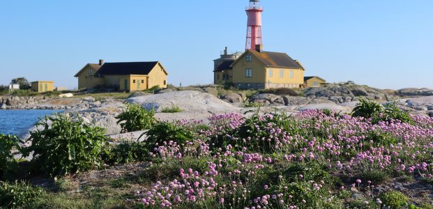
The basin we moored in was blasted out of the northern island (Norraskär) between 1939 and 1942 and was initially intended as a refuge harbour for fishermen. To make it as a safe as possible they built in access from both the west and the east so that it would be accessible whatever the wind direction (something much appreciated by more modern yachties!). They even put in storm gates which could be closed in the most inclement weather, but these have been out of operation since the start of the 1950s. On the southern island (Södraskär) the lighthouse was first established in 1789; this was just a basket with a light in it. The current tower was built in 1870 and replaced an older tower built in 1840 on top of an old fortress. The light was originally powered by colza oil – a non-drying oil derived from rapeseed, but this was replaced with a kerosene lamp in 1887. Electricity made it there in 1948. There were originally four people manning the lighthouse; one lighthouse master and three watchmen. They lived in the yellow houses on Södraskär and manned it 24 hours a day. They grew vegetables and herbs and kept cows, sheep, pigs, hens, geese and ducks. These buildings are now all listed buildings. Tempting as it was to have a look round Södraskär, that would have meant pumping up the dinghy and after a 65 mile passage a beer was a higher priority than pumping up the dinghy!